Coordinates
40.7128, -74.0060
Population
8.3+ million
Area
783 km²
Founded
1624 (as New Amsterdam)
The Urban Fingerprint
“New York City's streets are a vibrant mix of grid-like Manhattan avenues and winding Brooklyn lanes. A NYC road map print captures the city's energy and unique layout. Ideal for office décor, gifts, or as a travel memento.”
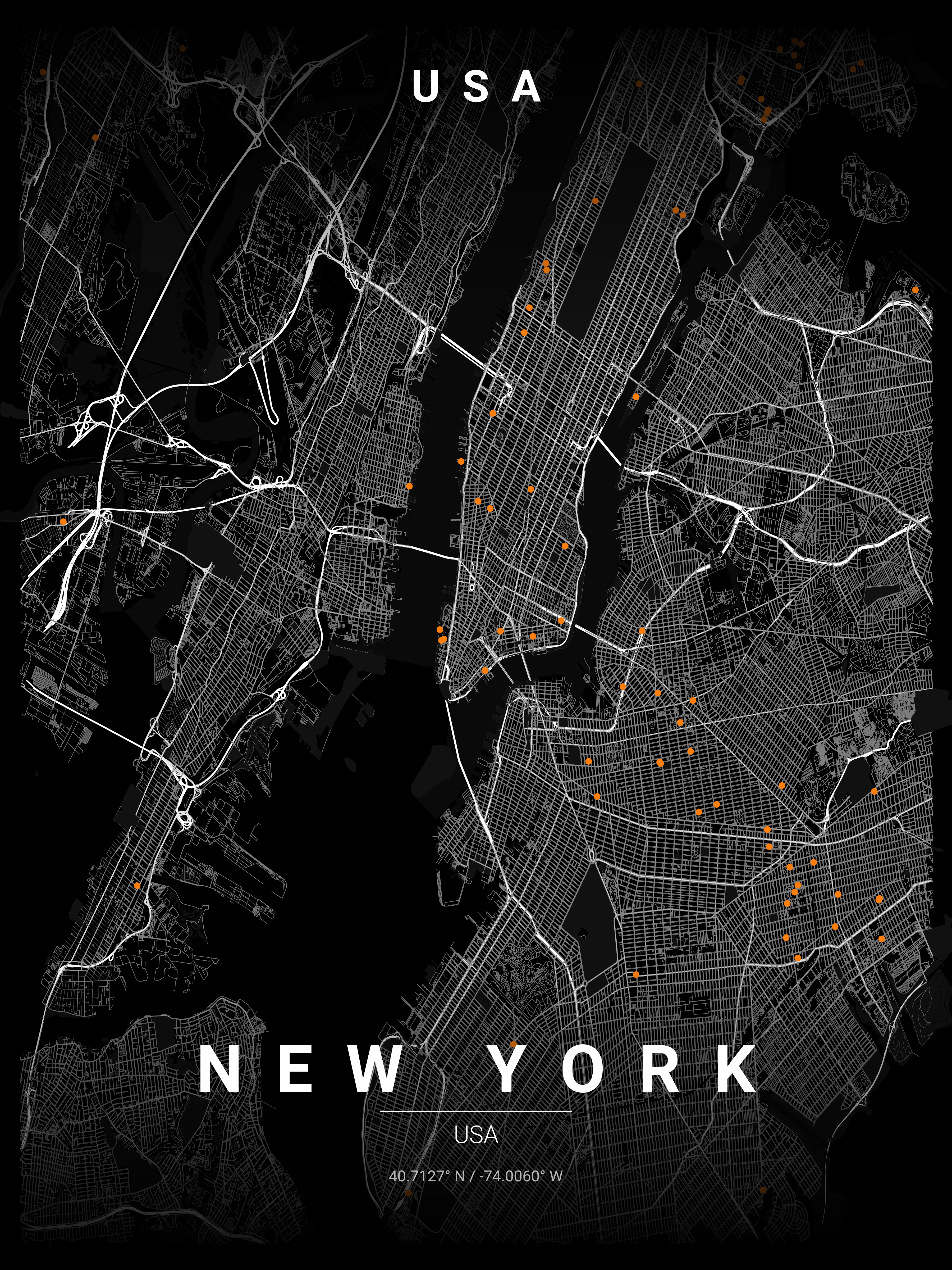
New York City (centre: 40.7128°N, 74.0060°W) contains the world's most recognisable urban grid: Manhattan's Commissioner's Plan of 1811 creates 12 avenues and 155 streets, bisected by Broadway's diagonal. Central Park forms a perfect 341-hectare void at the grid's heart. Our SVG export preserves the grid's mathematical precision at infinite scale — making printcityroad.uk the ideal tool for a high-resolution NYC map poster for printing at A1 or larger.
Interior Styles That Work
Recommended Theme
Blueprint
Our editors' pick for New York's unique street character and architectural heritage.
What You Get
Professional Grade
New York Map Prints
Vector SVG Export
Infinitely scalable — print at A0, A1, or any custom size.
300 DPI PNG
2400×3400px. Ready for any professional print shop.
17 Curated Themes
From Noir to Neon Cyberpunk — choose what fits your space.
Real OpenStreetMap Data
Every street in New York sourced in real time.
Technical Specifications
Technical Specifications
Map Download Specs
| Export Formats | Vector SVG · High-Res PNG |
| PNG Resolution | 2400 × 3400 px · 300 DPI |
| SVG Quality | Infinitely scalable vector |
| Print Sizes | A0 · A1 · A2 · 50×70 cm · 24×36 in |
| Colour Themes | 17 curated artistic styles |
| Map Data | OpenStreetMap (real-time) |
| Processing | Browser-based · No upload |
| Price | Free — no account required |
Map data © OpenStreetMap contributors · ODbL License · isBasedOn: openstreetmap.org
FAQ
Frequently Asked Questions
How does the Manhattan grid system look on map prints?
The Manhattan grid creates stunning geometric patterns, especially with Broadway's diagonal cut and Central Park's rectangular void. It's one of our most popular designs for its bold, recognisable structure.
Can I include all five boroughs in my NYC map?
Yes! You can zoom out to show Brooklyn, Queens, the Bronx, and Staten Island. Many customers love showing the contrast between Manhattan's grid and Brooklyn's organic street patterns.
What makes NYC maps special for wall art?
New York's distinctive grid, the diagonal slash of Broadway, Central Park's green rectangle, and the contrast between Manhattan and surrounding boroughs create an instantly iconic image that works beautifully in any space.
Ready to Start?
Generate Your New York Map
Free. No account. Vector SVG + 300 DPI PNG. Any city. Instant download.
Coordinates: 40.7128, -74.0060
Generate Free New York Map Poster