Coordinates
35.6762, 139.6503
Population
37+ million (metro)
Area
2,194 km²
Founded
1457 (as Edo)
The Urban Fingerprint
“Tokyo's urban grid combines modern avenues with traditional alleyways, making it ideal for detailed city map art. Capture the city's vibrancy and style in a personalised map print for your home, office, or as a gift.”
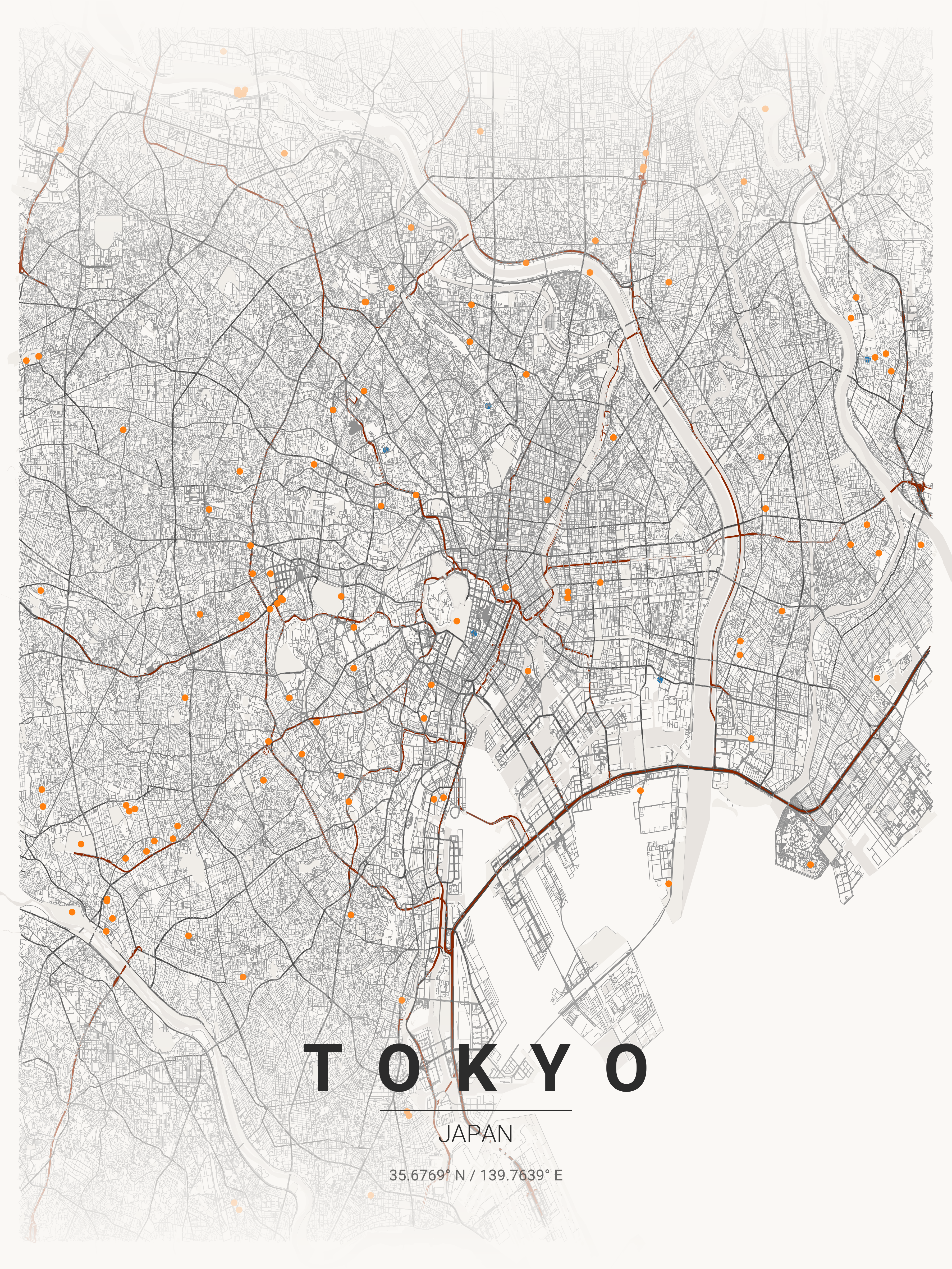
Tokyo (centre: 35.6762°N, 139.6503°E) has no grid — its 23 special wards follow historical waterways, feudal castle boundaries, and Edo-period land use patterns. The Imperial Palace creates a 3.4 km² void at the city's centre, surrounded by the circular Yamanote railway loop. This organic complexity renders beautifully in Japanese Ink or Midnight Blue themes. Printcityroad.uk generates Tokyo's full road network from OpenStreetMap at 300 DPI, capturing detail impossible to source elsewhere for free.
Interior Styles That Work
Recommended Theme
Japanese Ink
Our editors' pick for Tokyo's unique street character and architectural heritage.
What You Get
Professional Grade
Tokyo Map Prints
Vector SVG Export
Infinitely scalable — print at A0, A1, or any custom size.
300 DPI PNG
2400×3400px. Ready for any professional print shop.
17 Curated Themes
From Noir to Neon Cyberpunk — choose what fits your space.
Real OpenStreetMap Data
Every street in Tokyo sourced in real time.
Technical Specifications
Technical Specifications
Map Download Specs
| Export Formats | Vector SVG · High-Res PNG |
| PNG Resolution | 2400 × 3400 px · 300 DPI |
| SVG Quality | Infinitely scalable vector |
| Print Sizes | A0 · A1 · A2 · 50×70 cm · 24×36 in |
| Colour Themes | 17 curated artistic styles |
| Map Data | OpenStreetMap (real-time) |
| Processing | Browser-based · No upload |
| Price | Free — no account required |
Map data © OpenStreetMap contributors · ODbL License · isBasedOn: openstreetmap.org
FAQ
Frequently Asked Questions
How does Tokyo's unique street layout appear on maps?
Tokyo's organic, non-grid pattern creates fascinating abstract art. Unlike Western cities, Tokyo's streets follow historical waterways and feudal boundaries, creating a mesmerising maze-like pattern perfect for modern interiors.
Can I show the Yamanote Line on my Tokyo map?
The circular Yamanote railway line creates a distinctive ring pattern in the city centre. You can zoom to show this iconic loop that defines central Tokyo, with the Imperial Palace at its heart.
What areas of Tokyo work best for map prints?
Shibuya and Shinjuku show dense, energetic patterns. The Imperial Palace area displays the spiral pattern of the old Edo Castle. For contrast, the planned waterfront developments like Odaiba show modern geometric layouts.
Ready to Start?
Generate Your Tokyo Map
Free. No account. Vector SVG + 300 DPI PNG. Any city. Instant download.
Coordinates: 35.6762, 139.6503
Generate Free Tokyo Map Poster